Barley Brook

Before emerging from under the canal near the JJB stadium, Barley Brook runs from Whitley mostly underground.
It goes under the railway line near Spencer Road West IE it is on the West side of the track.
I think it could (perhaps still can) be seen behind the pavilions in Mesnes Park (East side of the track) before going underground again.
Where does it go under the railway between the park and the Spencer Road West area? Is it on any maps?
Or am I mistaken about the brook behind the pavilions?
Started: 17th May 2009 at 20:53
There is a brook that goes under the Railway as you say at Spencer road.It runs into a culvert on the east side of the track. across from the old factory.It disappears there and as far as I know doesn't come out on the other side of the track.I worked on this length of the W.C.M.L.for a number of years and can't recall the brook reappearing anywhere.
That's assuming I'm talking about the same brook.
Replied: 17th May 2009 at 22:04
Yes bluesman. ![]()
Same brook. The path on the East side of the line where the culvert is, is called Badgers Walk on some maps and I think it's called Beggars walk on others.
I suspect it must be piped under the Gillan Road area and crossing back under the railway near walkden Avenue.
I could be wrong though.![]()
Replied: 17th May 2009 at 22:33

i didn't know you were interested in this type of stuff,dostaf.![]()
You wouldn't think that a small drain like Barley Brook has a street, a foundry and a coal mine named after it.
Replied: 18th May 2009 at 18:35
dostaf
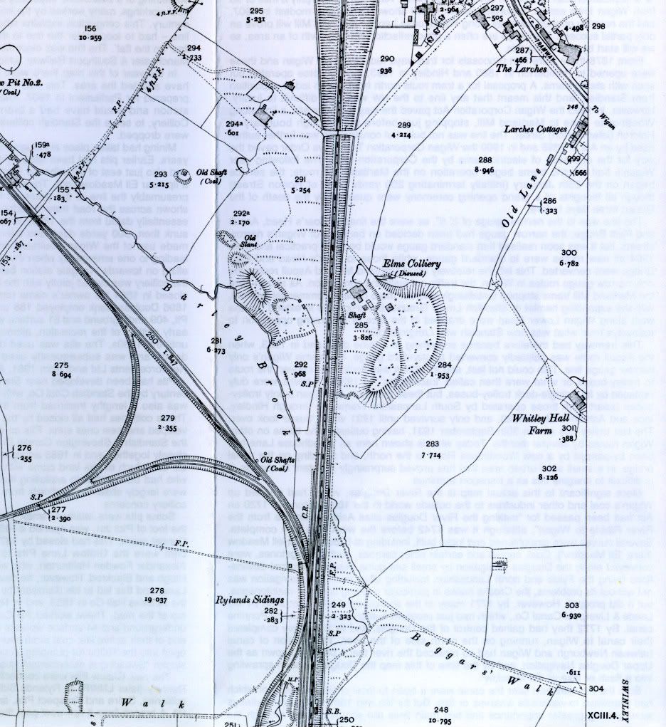
Is this 1908 map of any use?
Replied: 18th May 2009 at 19:59
Cheers gaffer.![]()
It was just a genereal question really. The subject arose following a mention of the brook emerging near the JJB. I suppose there must be many such waterways piped underground.
Am I right in thinking the Rylands Sidings are by what is now Milliken?
If so, it would seem that the brook comes from over Giant's Hall pit (as was) direction.
Replied: 18th May 2009 at 20:15
You are right about the large culvert behind the bowling green pavillions in Mesnes Park dostaf, there used to be a large pond that was fed by a stream on the west side of Buckley St bridge before Gillan Rd was built, that must have been culverted and built over. There is also another tributary to Barley Brook that comes from Whitley Mere and runs down between Whitley Crescent and Coniston Avenue goes under Danesway and then runs down Queensway before joining Barley Brook on Buckley St and then on to Mesnes Park etc.
Replied: 18th May 2009 at 20:29
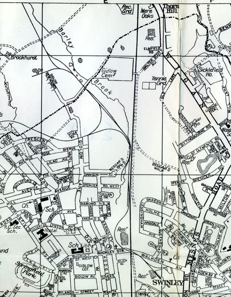
Just seen your other posting dostaf the brook on the map runs behind Gidlow cemetery if thats any help. ![]()
Replied: 18th May 2009 at 20:32
Dostaf,
I can't place milliken on the map.
This shows the brook adjacent to the JJB.
Replied: 18th May 2009 at 20:33
Thanks ayrefield. ![]()
It just had me thinking about how it seemed to change sides of the track.
Replied: 18th May 2009 at 20:35
Dostaf
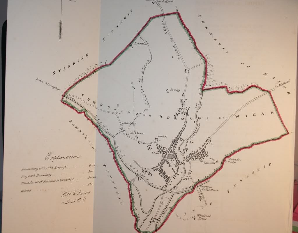
You are correct. Miliken is where Rylands sidings were you can see it on this 1952 map. The map is not as accurate as the OS 1908 map.
Replied: 18th May 2009 at 21:01
Nice one gaffer. ![]() From that you can see Beggars Walk follows the perimiter of Milliken. (Tupperware/ROF)
From that you can see Beggars Walk follows the perimiter of Milliken. (Tupperware/ROF)
I guess that the factory (ROF) isn't shown for secrecy reasons.
Incidentally, I notice on your previous map, you can see the original Wigan Pier or gantry (Gant) running from Meadows Colliery. ![]()
Replied: 18th May 2009 at 22:10

Is it Barley Brook you can hear under the road at the cross roads of Park Road and Gidlow Lane? I wouldn't have thought that it was a drain as your hear it constantly and consistently?? ![]()
Replied: 20th May 2009 at 12:56
Is it Barley Brook you can hear under the road at the cross roads of Park Road and Gidlow Lane? I wouldn't have thought that it was a drain as your hear it constantly and consistently?? ![]()
Replied: 20th May 2009 at 12:57
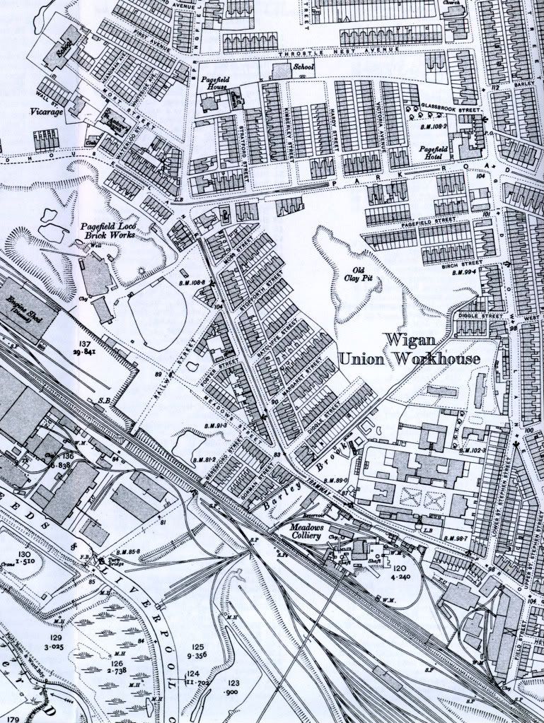
GAFFER, is that map 1908 too, cos my 'ouse isn't on it! Looks really wierd....i used to play in the little play park that is marked as "clay pit" on that map in front of Ratcliffe Street
Replied: 20th May 2009 at 13:16
Nicola,
If you give me the area where your house is I'll look on both maps.
Replied: 20th May 2009 at 15:56
it's awreet gaffer, i know it was build c.1930, just to see an old map without it on is a bit different, shows me how Park Road developed, imagine, no Muffin Man!! ![]() Where would you get yer pie onna barm?
Where would you get yer pie onna barm?
Replied: 21st May 2009 at 09:26
i have a map date about 1830 and its birley brook different spelling , i would download a picture of it but i dont know how ![]()
Replied: 7th Jul 2009 at 18:18
[
Replied: 7th Jul 2009 at 18:35
Last edited by antar: 7th Jul 2009 at 18:38:43
Hello antar.
use the photobucket etc. address put
[img= before it
then ][/img] after it. No gaps in the line. ![]()
Replied: 7th Jul 2009 at 18:45
Replied: 7th Jul 2009 at 18:58
just a bit big , ill get the hang of it now thanks dostaf
Replied: 7th Jul 2009 at 19:00
Thanks for all these maps of Barley brook. My interest is in the Cubs Hill and scouts hill near Whitley crossing
Tony
Replied: 14th Sep 2009 at 22:36
further to barley Brook. it ran along the Daisy field with cubs hill on other side of brook. Now tres are covering the whole lot. I understand they were planted by Wigan High School girls in the sixties. Now it is very difficult to access or get your bearings. Why have no dog-walkers complained about this loss of walking amenity? Like fighting your way through jungle. Any one know where map that would show all this?
compingnut
Replied: 25th Sep 2009 at 10:12
I'm sure Barley Brook was visible at the bottom of Diggle Street (off Gidlow Lane) 1n the 60s and 70s.
I may have a look when I'm passing see if it still is.
Replied: 25th Sep 2009 at 13:06

Funny that Bennie, walking home last week I noticed what looked like an old culvert at the bottom of Diggle St, the arch the only remain. There may be something in that.
As for Whitley, you can see it clearly as it runs under the line and emerges through a culvert. Just follow the path up near the hill.
Spent lots of time in there as a kid pratting about, but of course everything has been "spiked up" now.
Replied: 25th Sep 2009 at 16:57

Bennie Barley Brook was visible at the bottom of Diggle Street certainly in the 50's it went back underground to cross Frog Lane. It was very polluted at that time.We used to play in it as kids
Replied: 25th Sep 2009 at 20:40
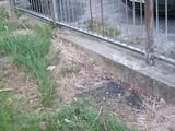
It was there till at least the 70s Copperhead , I've been down today and took some photots. There is a manhole cover by the wall in the field and BB will be under there.
Replied: 25th Sep 2009 at 20:49

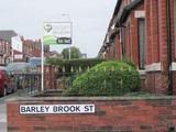
Barley Brook Street which links Gidlow Lane and Hodges Street certainly covers the stream ,one of the houses on Gidlow Lane had recurrent flooding in the cellar and on investigation it proved to by the stream causing it when is swell.
This is about where Barley Brook was visible at the bottom of Diggle Street.I think you can see part of the arch that may have been part of the culvert.
Just on the field a manhole cover that almost certainly is for access to Barley Brook.
Replied: 26th Sep 2009 at 20:40
Last edited by bennielechat: 26th Sep 2009 at 21:00:45
Yep that's the one Bennie. I assume it to be piped under here now.
Replied: 26th Sep 2009 at 23:33
Don't think it was an 'arch'. More like a parapet at end of street.
See gaffer's map 18 may 20:33
Replied: 27th Sep 2009 at 15:39

This map is my contribution to this topic, for a reference point Gidlow House on the map is where Beech Hill Health Centre is on Gidlow Lane (not Boston House) approx halfway between the Park Road junction and the Buckley Street junction ![]()

Replied: 28th Sep 2009 at 16:58
Gaffer, thanks for the map you put there in may. I have a copy of that map of Wigan, but I didn't know what the date ... couldn't find a date on the sleeve, I now have it thanks to you.
Replied: 29th Sep 2009 at 07:38
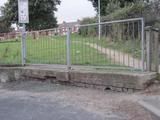
I thought I'd return to the spot where I remembered seeing Barley Brook at the end of Diggle Street and from maps,memory and instinct I worked out that the stream roughly followed the old wall that was part of the old Cleansing Depot and now home to Boston House.

It reaches this fencing.

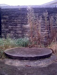
And just on the other side look what I found -a massive concrete access point (Boston House in background) that must surely be to do with Barley Brook. Go to the end and you're at the Frog Lane/ Woodhouse Lane join.
Replied: 29th Sep 2009 at 19:29
Last edited by bennielechat: 29th Sep 2009 at 19:31:52