Photo-a-Day (Monday, 3rd July, 2023)
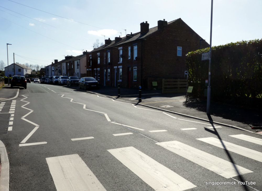
New Crossing

Photo: Mick Byrne (Panasonic DMC-TZ100)
That crossing isn't new. It's been there at least a few months now.
This crossing is not just any old crossing, its part of the Wigan bee network of the Standish Mineral Line that goes through the new housing developments. This scheme will extend the Standish Mineral Line to connect it to Junction 27 of the M6. It will provide additional and improved sections of on and off-road facilities, creating high quality multi-user routes (walking, cycling, equestrians and wheelchair). The improvements will resurface existing informal routes, public rights of way, and bridleways, providing new connections, crossing points and links to new housing developments.
Is a part of Old Pepper Lane in Standish and a part of it Shevington Moor, please? I know there is a Pepper Lane in Standish and thought Old Pepper Lane was there too.......does it straddle between the two places?
Mick you'd should have been taking the photo near the edges to the right, that way your not against to Sun.
I know road signs are needed but to me it looks messy… they seem to go overboard at times and it can cause confusion looking at them.
Irene, I'm sure Mick will have a more official answer but grew up around there many years ago and from my point of view Old Pepper Lane up to the Robin Hill estate I'd class as in the Shevington Moor area.
Pretty sure it falls under Shevington council wise but everyone round there would understandably class themselves as Standishers rather than Shevyers
Irene, as you say, Old Pepper lane runs between Pepper Lane and the end of Almond Brook Road which becomes Shevington Moor at the T junction.
Goodness Mick , whatever have you been reading ? That's serious metro speak .
Dave, too serious for the real Mick.
Looks like quotation marks should have been used! “…….” And where they came from and credit due! But helpful anyway from the original author.
WN6 0PY Pepper Lane is in Standish, Mick.
I thought the stuff Mick wrote, if it was Mick ?Was very techy & council sounded like Highways or council speak.
Also isnt there anyway you can stop people making comments using other peoples names?
Remember when delivering some kitchen base units to a new house on a road they had begun developing off Old Pepper Lane around 1968, we had a key and knew the number but no numbers were on any doors, we were told which house it was at the site office and so we delivered and put the key through the letterbox has told. The next day an irate customer was on the phone wanting to know why they hadn't been delivered, we told them we had done, turned out the site office had pointed out the wrong house, also all the back door keys fitted each house door lock, no one knew and wouldn't have known only for us having been told the wrong house. The householders with a kitchen full of new base units were puzzled as equally as was the police when called.
There are some vast housing estates around there and even more to be built and its identity as a rural village long gone.
I'd imagine too the self prescribed substance delivery cycles making full use of these conjoined mineral lines, cycle paths and back alleys, they'll be blending in and also be practically concealed and off road.
Mick may have copied his info from a leaflet or copied and pasted from council online leaflets about the Bee project and the crossing, one here: https://www.wigan.gov.uk/Docs/PDF/Resident/Parking-Roads-Travel/Travel/Junction-improvements/Bee-Network-Standish-Mineral-Line.pdf
As you can see the estates built and being built up there are massive and I agree that these crossings would be needed, we had a vet on Shevington Moor so do know that the road is used as a rat run from the motorway to go along Old Pepper Lane to get onto these estates also to get onto Pepper Lane, the speeds of the vehicles was then and more than likely still are horrendous, especially for going along what are residential roads with 20mph signs.
Helen of Troy, some people prefer not to use their own name, they prefer to use, if you will a decoy or an angle name.Some use only their first name.
South of Almond brook is Shevington Moor.
Almond brook runs under the road just behind the photographer.
Mick, is that all, I thought you were going to write some romanticised spiel on how Almond's beer was being brewed using water from this brook and it was this water that gave it its taste, and that was how the brook became to be known as Almond Brook.
That crossing is actually in Standish, not Shevington.
The boundary is Almond Brook, which passes under Old Pepper Lane in a culvert where the two inspection covers are seen in the picture.
The culvert is where I said it was, behind the cameraman, it went under the road then went at the edge of the lane to the end , it was covered over with a bridge made from old railway sleeper at the end Brookfield road