Photo-a-Day (Monday, 16th March, 2015)
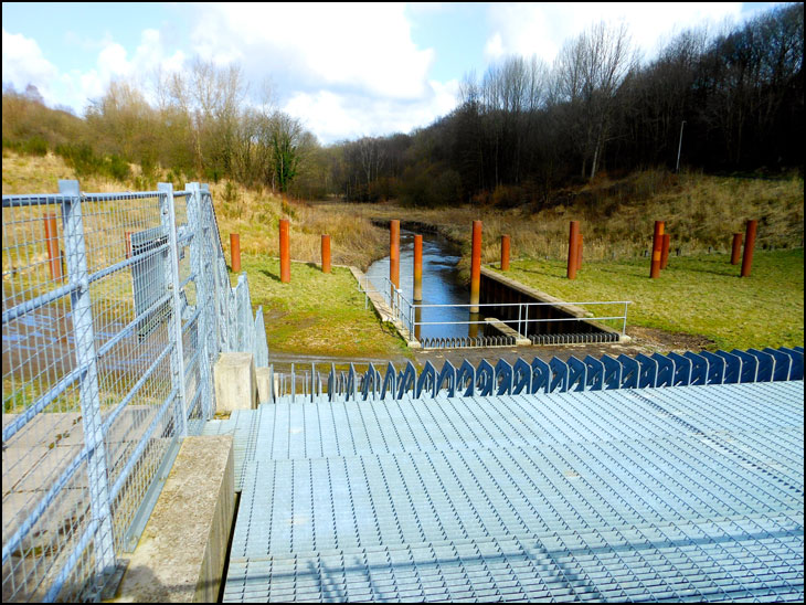
Flood Defence

Photo: Roger Whistlecroft (Nikon Coolpix)
It looks like the exit flume is 5 or 6m wide. Does the entire flow of the Dougie go through there when it's not flooding?
What a good idea this was, protecting Wigan from future floods,,
Where does the River Douglas start and end??
Or is it a tributary of another larger river?
How does this flood defence system operate?
Hi Giovanni, the Douglas starts at Douglas springs near Rivington. It then meanders its way through Adlington, Wigan, past Parbold, past Rufford (where the Yarrow river joins), past Tarlton (where the Rufford branch of the Leeds & Liverpool canal joins it), eventually flowing into the Ribble just after Hesketh Bank.
Thanks Robert
Robin,
The channel in the photo is where the water 'enters' and passes through the dam (the picture is an upstream shot.)
At times of flood, the entire area in the photo will fill with flood water as its is held back by the dam: see this photo http://www.hydro-int.com/UserFiles/news_images/Wigan%20-%20flood%20storage%20area%20part%20full.jpg
In the dam itself is a Hydro-Brake which allows the flood water to flow through the dam at a predetermined rate and which does not cause downstream flooding: see this video https://www.youtube.com/watch?v=J99u6NCJSOU
Thanks, Neil. I stand turned about and set straight.
Many thanks for all the info Neil. Very interesting, and as Mick says, what a great thing for wigan to have.
Thanks Robert for the info.