Photo-a-Day (Thursday, 25th March, 2010)
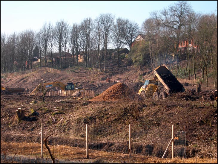
Dam

Photo: Harry Cunliffe (Nikon Coolpix 7900)
Is this near the river Douglas? If so it's going to make a mess of some great walkings
What a mess, hope they put it back to how it was. Years ago I walked our dogs on there and then along the path into the plantations. It was known locally as The Strogs
I'm trying to think where this is. The Coppull Lane I used to know was a steep cobbled path that ran from the Douglas to the near bottom of Moore St. East; or on to Bradshaw St. Or have I got it wrong?
I have got it wrong! What I was think of was called - I think - Malloney's Brow. Can anyone clarify this?
You're right David,the houses at the top of the hill are on Widdrington Road. Where they are digging if you go further along you come to the rear of The Bellingham Hotel and Tennis Club and then into the Plantations just before the River Douglas bridge. I think those cobbles have now been tarmacadamed over, as the Environment Agency put in a new entrance road from Wigan Lane for their lorries.
Im disabled 84 year old pentioner using a power weelchair
been near to the work site,
for reason given was ask go back the way I came.
Couldnt take it in how big the prodject is.
Would like too see a large scale map of intended work.
Or have a discushon with a Engineer.
You Can't walk along the river from the bottom of Great Acre up to the steps near Chestnut Road. if you walk through the Plantations to Wigan, you have to detour up to Wigan Lane.
Has Wigan had many flooding problems recently?