Photo-a-Day (Monday, 29th May, 2023)
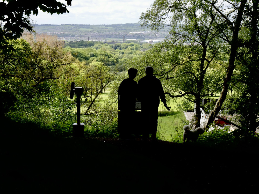
Douglas Valley

Photo: Dennis Seddon (Sony DSC-WX500)
Douglas Valley is in between Ashurst Beacon and Parbold Hill.
This is a view of Wigan
Ey-up, it's Howard and Marina!
Oh dear all these years I have thought that the river Douglas flowed between Wigan and Haigh, thanks for the correction Syd
Very artistic Dennis !
I like the silhouettes looking over the verdant countryside
- plus the little dog. Really good…
I would argue that the town of Wigan is, in itself, located in the Douglas valley.
Why nitpick over a lovely romantic photo.
Syd with you being a renowned dog hater it's obviously not you in this wonderful photo. By the way according to maps and Walking the Douglas Valley Way, Douglas Valley begins at Wilderswood at Rivington and ends where the river meets with the River Ribble near to Hesketh Bank, interestingly the river is known as the River Asland from Rufford, probably attempting at appearing as being to be posh and nothing to do with those commoners to the East.
No matter what the name Douflas, Asland or Ribble it'll still be highly infested with those intensely proliferating wild brown trout, which are forever being bunglingly released from sewage farms into our waterways. Dennis, apologies for having a rant on your wonderful scenic PaD
Feel free Cyril, nothing like a Bank Holiday for having a good rant. Usually it's one motorist to another, but I don't see why they should have ALL the fun.
Besides, the last time I looked the River Douglas was running through the plantations and the centre of Wigan. Or as the flippin' Council been moving things again?
The Dougie even ran through Scholes and it has its own posh bridge at the end of Scholes beginning of Millgate…who’d have thought it?
River Douglas is running through a dip in the land, that's all, its not what anybody would call a valley.
A valley is an elongated low area often running between hills or mountains , Ashurst Beacon, a hill, Parbold hill, a hill.
True Dennis, I've been hearing a few vehicle horns blaring at the mini-roundabout near us, mind you that happens all the time and not just at Bank Holidays. The river Douglas (and not the Douflas that I'd put) did form a valley that Wigan sits in, hence Riverway, he likes to make a gibe does Syd, even though we all know who he really is.
Perfect example Veronica, as you go down the hill of Scholes to there, and also go down the hill of Millgate from the town centre to there - and there you have it a wonderful, naturally formed valley, which you Tom have just described for us, so glad that Syd and yourself agree with everyone.
"The river Douglas did form a valley that Wigan sits in"
Really, it didn't. The 'valley' created the River Douglas.
The valley was created by the draining of what is now known as the Lancashire Plain, long before there was anybody who could say "River Douglas".
Valleys are formed by “erosion of the land by rapidly moving water over a long period of time”. The water came from the melting glaciers from the Ice Age. So the valleys are there because of the weight of water forming rivers and streams…..in other words the water formed the valleys…
Bruce, if the water flowed from the “Lancashire Plain” it would have to flow in the opposite direction to what it does and it would have to flow uphill to Winter Hill. How would that be possible?
here's a thread from 2007 about the River Douglas and where it did and didn't flow, seems that Tonker, or maybe it's now his son Bruce that is still arguing that it doesn't flow anywhere near to Wigan: https://www.wiganworld.co.uk/communicate/mb_message.php?opt=f1&msd=20631&page=1391&subject=the%20river%20douglas