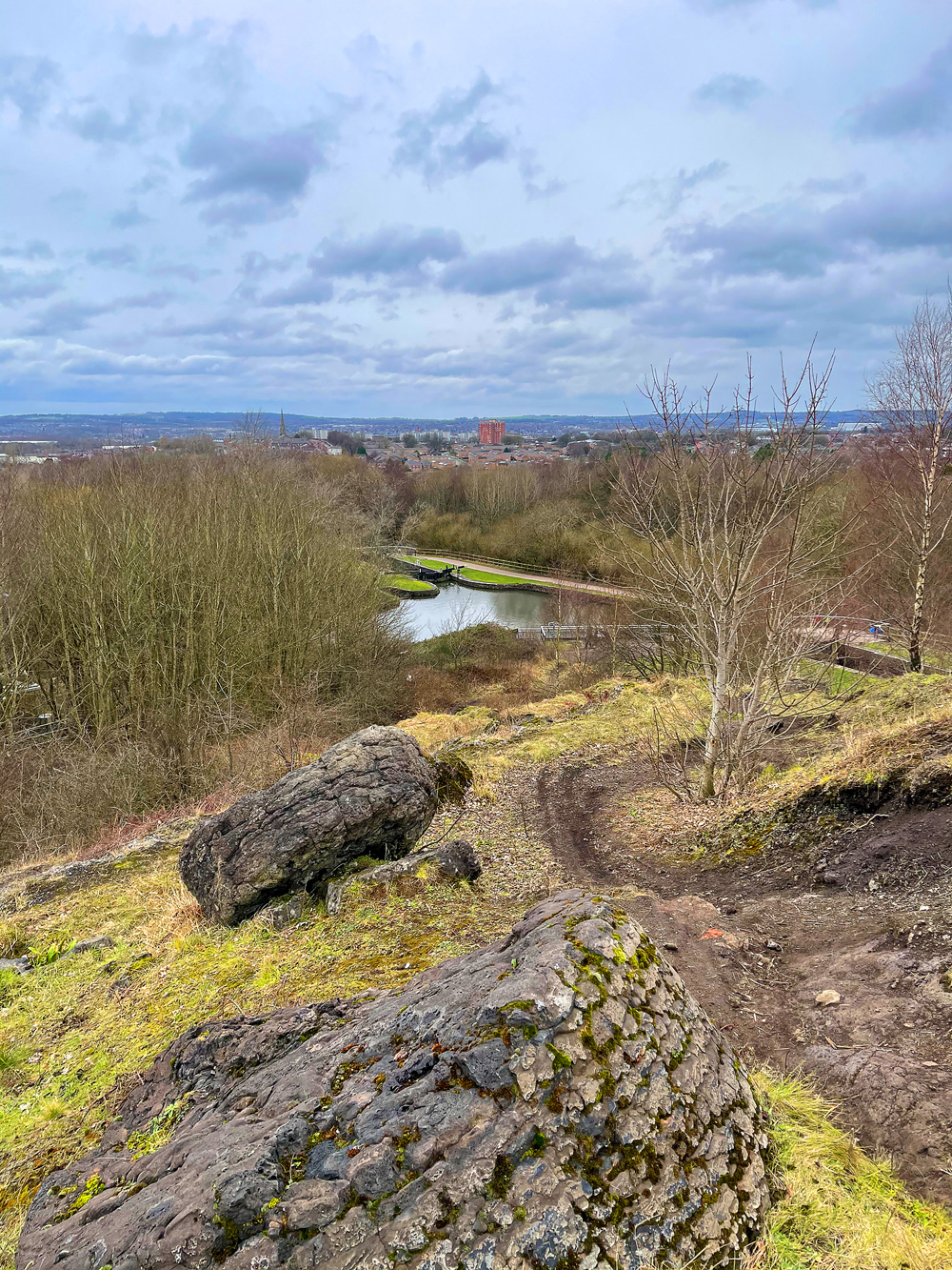
Photo-a-Day (Friday, 19th February, 2021)
Wigan from Rabbit Rocks

Photo: Dave (Oy) (iPhone 12 Pro Max)
Great photo, Dave.
Just below is where the Whelley loop railway line ran and a iron bridge over the canal then on to Standish , to the left to De Trafford junction and Hindley.
Incers are so lucky to have the Kirkless Nature Reserve on there doorstep
On a clear day they can see the Gathurst viaduct and the whole of Shevington from that view point.
I remember The Rabbit Rocks so well from childhood. Those huge oval shaped "rocks" were, I think, some kind of residue from the ironworks and they seemed much more solid than they do now. I imagine they have softened and crumbled over the years.
A much more scenic view than it was in the fifties. The air even 'looks' cleaner..the sky looks lovely and natural - as opposed to being 'touched up'. ( although I'm no expert in these things.)
ONLY Incers called it Rabbit Rocks to us the other side of the 'cut' it was simply 'The Rockies'' - been going up there sixty years and never seen a pesky rabbit yet - think Elma Fudd comes out at night!!
Maybe you can't tell the difference between a dog and a rabbit, scholes malc.
Lovely photo .
One things for sure, it isn't the highest point in Lancashire.
Plenty rabbits and hares around that neck of the woods.
IT'S in Ince so Incers are entitled to call it Rabbit Rocks.
It's the highest point in Ince.
Irene, I think you will find that that is from the steelworks side of the operation. The Iron slag was tipped just off Hemfield Road. Remember the story of my great uncle Evan trapped under the locomotive that turned over?
Thankyou Neil. Yes, I think I must have meant the steelworks, (a lad, rather than a girl, would probably have known that!), and I do remember the story of your great Uncle.