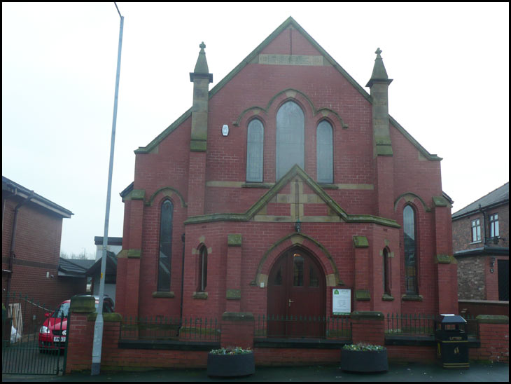
Photo-a-Day (Friday, 25th January, 2013)
Almond Brook

Photo: Alan Banks (Panasonic DMC-TZ3)
alan keep the lens cap on !
Think I saw this church building on my rambles on google maps Alan, as you come down old Pepper Lane and turn right, just a little way up on the left...could be wrong.....cheers!!!
Eddie , I hope you don't mind my saying,but I think your comment is rather harsh. People from all over the world look on this site to see all aspects of our town ,buildings,countryside
town centre, etc. As has been said before isn't a competition,just like minded people ,with the good of Wigan at heart .
I was up Beacon road the next road up from this church on Tuesday and it looked like they had scaffolding up at the back of it.
That,s where it is Lizzie, had you been googling your old house at the time?
So many buildings are having a change of use these days, but better than being knocked down. Good archival shot Alan. Agree with Thomas about your comment Eddie, however, would like to think it is a bit 'tongue in cheek'?
I'm agreeing with Tom too, eddie. That's what these shots are about, in and around Wigan. Good one Alan.
eddie, do you live in the Wigan area? If so, let`s see what you can post on P-a-D.
Thought I had seen it before....yes Roy I had been taking a nostalgic walk.....:-)
I did notice that at the junction of Old Pepper Lane and ABR the little stream has disappeared with the old brick bridge over it...there are houses built on the place it used to be......bit sad.....anyway they wern't going to leave it there just for me.....cheers!!!
Lizzie, it's good to see that someone else indulges in Google "rambles"!
eddie, out of order! This photo will be of interest to some people.
Ellen I love doing them.....I couldn't believe that I could go down my old street that I had not travelled for over 40 years.....magic...cheers!!
Lizzie How do you do that? Would you direct me please.
That,s Almond Brook Lizzie, it can only have been diverted, i,ll try and find out 'where it went'.
Ann I use an iPad an have google maps so I tap on the map app icon then type in where I want to go on a virtual keyboard then the map comes up with a pin drop. I tap the little person icon and hey presto it takes me to the spot.
Thanks Roy that would be great...will check back on thisi pic.....almond brook runs at the bottom of the land of my old home.....guess that is why it is called Brookhouse....cheers!!!
Almond brook runs in a pipe under the garden of little bungalow on the corner of pepper lane and shevington moor.
Its where Almond brook starts that Ive been looking for for years.
The brook runs under the road from right to left and then yes it is piped alongside old pepper lane then turns sharp right running alongside Brookfield rd and on into a large pond, which used to be at the back of the old coal mine, which closed down around 1960.
The brook starts in the fields on the other side of the dual carriageway joining another brook which runs down into Shevington and ultimately Standish Lower Ground I believe.
I used to live at the shop in Almond Brook and played for hours along the side of the brook with all my mates from Almond Brook.