Photo-a-Day (Thursday, 24th February, 2011)
River Douglas

Photo: Mick Byrne (Sony camcorder HDR)
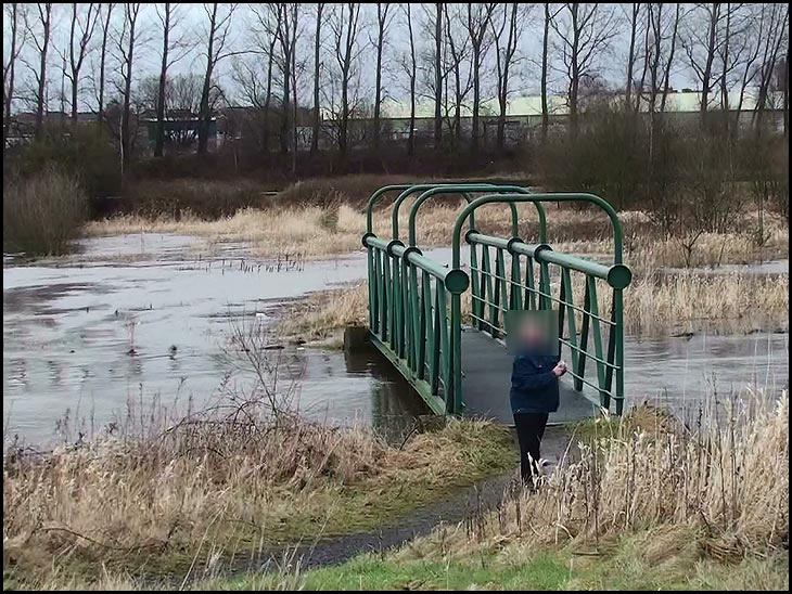
the bridge to nowhere?
Thanks for posting the photo Mick, I didn't know that 'Green Bridge' still existed, it was on a footpath that at one time led from between the houses on Scot Lane near to where the Hope School was to the canal towpath, from where you could get onto Frog Lane. The path doesn't look to be still there on the other side unless it is submerged.
Gosh that does look to be really flooded, If the water was'nt so high would the bridge lead to a path? Looks like the old chap in the picture is watching you.
Cyril
Is this the one that could be reached down past the 'Big Hill' , off Eccles Road at Kitt Green.
Down the track past the old Manor House and under the railway bridge?
If so it looks a bit more sturdy than the one I knew. My friend and I used to run across it when we were small, stamping our feet to make it shake and vibrate.Thank you for the memory, Mick
Silly photo, means nothing...It's almost spring crocuses, snowdrops and many spring flowers are out, come on get out there.
that river looks really swollen that old man should not be so near to it taking photographs
I thought the old man was fishing and his rod had been taken away!
Why has that old man got a fuzzy box on his head.
Tricia, the green bridge your thinking of led to Crooke village didn't it, whereas this one is at the back of where Walmesley's was at Springfield.
Thank you , Cyril, for an intelligent reply.
As for people like John, if you don't like or appreciate the effort put into these photos , don't look... go somewhere else with your Juvenile remarks. Can you do any better ???
Just for the record I knew these places as a child and they interest me and lots of other people on here.
Cyril... yes it did lead to Crooke Village..thanks for that.
Is this one going down a path from Scot Lane to Woodhouse Lane.? It went past the sewage works and over the 'white bridge' on the canal and into a a side road and you were roughly were Frog Lane and Woodhouse Lane meet up.
Tricia, go and peel some spuds.
The photo's a bore.
the building in the back ground is pemberton caravans the photo has been took from in front of the DW gym
Freda this path is a bit further up than the one you are referring to though it does lead to where the white bridge was, the path came out between those houses on Scot Lane opposite what was the Hope school now Hope enterprise centre, the entry is now blocked off, but I don't think anyone used it after the rubbish tip or Gant extended over that way. The one at the bottom of the sewerage path had bogey tracks across it where obviously at one time they pushed containers full of you know what, no idea where they dumped it, but I remember folks going down there and along the river bank for soil to put on their gardens, then they were troubled with the Himalayan Balsam that grew down there sprouting up in their veg plots.
A couple of right snappers there lol