Wigan Album
Lymm St./Boundary St. area.
3 Comments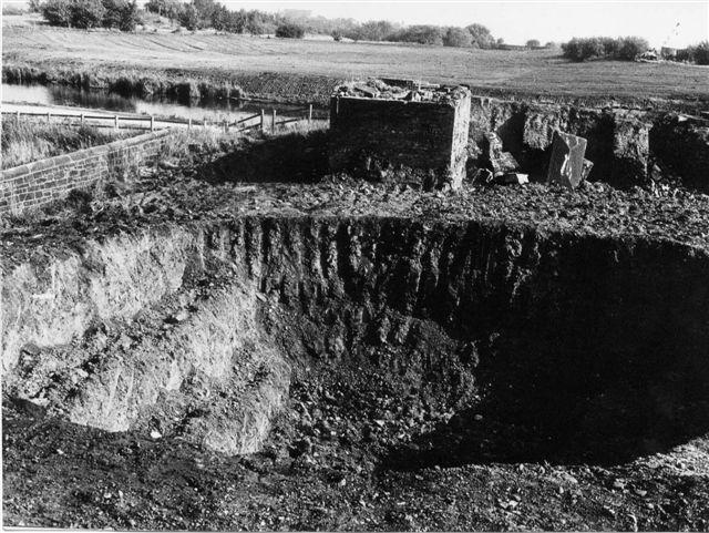
Photo: Allan Greenwood
Item #: 8804
is is not at the back of heatons bakery look in the distance is that ince parish church
It's the remains of the northern abutments of the railway bridge over the canal, which has featured in some of your pics. You can just make out the jib of a crane in Ainscough's yard in the top right-hand corner, with, to the left of the bushes to its right, part of the embankment of the Wigan-Manchester line and the, as said above, Christ Church's roof further over. If you go to the spot where the hole is now there is a large manhole - presumably the waters of Clarington Brook were culverted and diverted from their ealier course along the side of Boundary Street. On the far side of the canal you can see that an excavator has been at work recently, grading the bank where the southern bridge abutment once stood. The railway tracks, water tower, turntable and all, have been removed and the ground landscaped. It is now covered in scrubland and trees.
Thank you for that explanation. I thought that that is where it must be, but it just looked nothing like I last remembered it.