Wigan Album
GOAD MAP 1983
4 Comments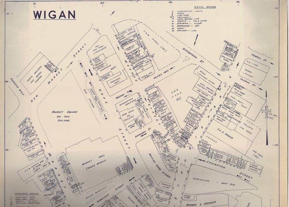
Photo: RON HUNT
Item #: 34584
THANKS TO PHILIP CUNLIFFE FOR THE MAP.
JUST REALISED THAT IF YOU INCREASE THE SIZE OF THE MAP YOU LOSE SOME DEFINITION. IF ANYONE WANTS A BETTER IMAGE EMAIL ME
Wigan hadn't changed to much by then. I see the old bus station where & I caught the bus to Ormskirk....the site of the demolished Congregational Church , then cross Menses St by the Scotch Bakers. Up the alleyway called Back Menses St on the map, to the house where my Uncle & Auntie lived, I lived wth them for a while. It was an old 3 storey house with a yard & the front door straight onto the pavement. The front windows looked out onto Dicconson St, where the carpark is marked for 50 cars. I shall enjoy looking at the places I knew...if they were still there in the 1980s. Thanks Ron.
Ho Ron being an old OS surveyor yes i would love to take you up on your offer of a better image i am only to glad to ask for one , YOURS Golden Bear .
Just had a good look at this map to see just what the town centre look like 40 years ago. I don’t remember Barclays being on the corner of Hope St & Marsden St behind BHS - did they move to Market Place when Lowes closed in 1985?
CJ