Wigan Album
Standish
11 Comments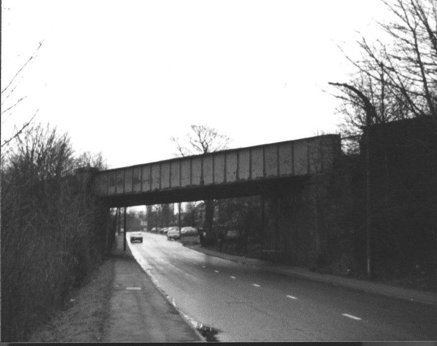
Photo: The Wigan Courier
Item #: 8475
This must be the old Whelley loop line coming off the main line from Standish Junction. This ran from Standish to Bamfurlong, or was it Hindley South? via Haigh Hall.
this was the line that ran from the Glasgow/London main line and over the twenty bridges and then onto the whelley loop eventually going through Hindley south station and beyond.
lovely nostalgic picture
thanks for sharing
This line never went through Hindley South station - that was on the old Wigan - Tyldesley - Manchester line. The only station on the Whelley loop line was actually Whelley which shut in the 1870's. It went through Amberswood and reconnected to the west coast main line at Bamfurlong just south of Springs Branch.
Spot on Steven; but wasn't there a link to Hindley South somewhere along the way?
This line was so interesting. There were may links with other lines (junctions). This part of the line being a later addition, from the Whelley junction at Sennicar Lane. There was indeed a junction for it to join the GCR line at Amberswood East junction which ran to Hindley South. Another branch followed which joined the Wigan NW to Manchester Exchange line at Strangeways East junction. However, for the majority of its later use in life, this line was solely a bypass from Bamfurlong junction to Standish junction. This was used for freight and express tains to then (quote), avoid the heavily congested Wigan North Western. What a change today!
sorry steven but your wrong about the line not going through Hindley south
there was indeed a junction that allowed trains to run through the station,you can actually walk the line and see for yourself
The Whelley Loop Line left the main line at Standish Junction just south of Rectory Lane bridge. It then went over Chorley Road, through Haigh Hall Plantations and under the road to Aspull at Whelley. It then went through Higher Ince crossing Belle Green Lane just south of Bryham St. then on to De Trafford Junction, where there was a connection to the Lancashire & Yorkshire Line from Wigan Wallgate to Manchester. From here the line went under the L&Y line then over Wigan Rd. at Hindley and on to the Amberswood Curves (which formed a triangle). At this point a train could take the east curve which would take it through Hindley South which was actually on the Great Central Line from Wigan Central to Manchester Central (now G.Mex). The Lancashire Union Line (Whelley Loop) formed the west curve which went passed Spring View Cricket club Then went under Warrington Rd. and the Wigan, Tyldesley Manchester Line and rejoined the main west coast line at Bamfurlong.
Sorry, yes there was a Hindley South on the G.C that could be accessed from the Whelley line at Amberswood - I got mixed up with Hindley Green on the Tyldesley line.
I do like this picture!!! Does remind me of Christmas 1971! So, there you go: 'Happy Christmas 2008'.
We walked the 20 bridges line to here and wondered how the track got from left to right.
Has the level been lowered on the left from its original height? Walking from the viaducts, there’s a considerable height difference between each side of the road.
When the metal track bed part of the bridge was removed, the brick abutments on either side were taken away too, with a sloping embankment produced and tree's planted. The last time I walked from here to 20 bridges, access to the bridge had been blocked. Is that still the case Tom ?