Wigan Album
canal bridge
8 Comments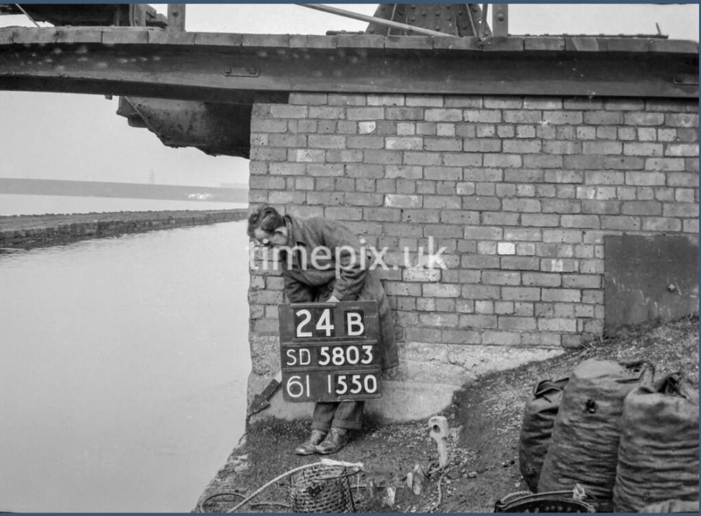
Photo: . Ozy .
Item #: 34970
"is there owt i'theer', laaaaike"?
"aye, a shoppin' trolley an' an owd baaaaike. An'a few gudgeon"!
Looks like Moss bridge with Scotsmans flash in the picture, and the railway line in the distance. I spent many hours in the area as a boy and knew it well, but I seem to remember the bridge being all stone - not brick. I'm puzzled.
I would agree Mr Brown .
Having looked at Moss bridge on street view , it’s evident that this must be some other bridge … but which other ? … I too am puzzled .
I’m puzzled too. Moss Bridge is a stone turn-line bridge - and the only one in SD5803. It doesn’t look substantial enough to carry the Pemberton Loop Line - which is in the next square North anyway.
The captions on this site are sometimes wrong - but you’d expect the information on the board to be right.
Back in the late 1800's, Moss Pits, near Wigan Cemetery and Springs Branch, ran a couple of rail lines to the canal, about 100yds on Pearson's Flash side from Moss Bridge, to load their coal onto barges, hence the coal bags featured on the image. The structure stops abruptly over the canal, in order for the coal to be tipped. Only trace now is a slight narrowing of the canal at the site.
I’ve spent most of the afternoon studying O/S sheet 40/50 against the information on the survey boards and have arrived at the same conclusion as Jodd .
The structure in this shot must have stood 100 metres or so north of Moss bridge on the eastern bank of the cut and served as a discharge point to load the canal barges with coal from Moss Pit colliery , which seemingly occupied most of the east bank as far as the railway track which is now the Poolstock lane bypass .
The clue to the precise location lies in the numbers 2 and 4 within the grid square SD5803 2 being the eastings and 4 the northings .
Using the information on these boards in conjunction with an O/S map , it therefore becomes possible to pinpoint accurately the location of any photo on the Timepix site .
And as Jodd points out , this would also explain the kebbing equipment and what appear to be filled bags of coal .
Kebbing for coal was also a popular pastime at the tippler in Crooke village .
The tippler north of Moss Bridge is just visible on another image of it.
Just found it David . Image No 21 on the Ince section .
Well spotted . I hadn’t noticed it previously .
Jodd said that the colliery ran a couple of lines to the canal and he was perfectly correct , as on the large scale map provided by John on the image taken at Kirkless , both are visible , side by side and each apparently terminating at its own tippler .
So presumably the other one is being obscured by the field labourer . But there I go … guessing again .