Wigan Album
Standishgate
2 Comments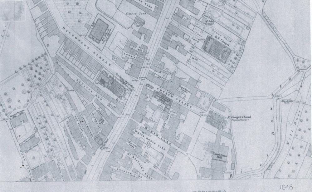
Photo: RON HUNT
Item #: 34848
THANKS TO JOHN FLEETWOOD.
Thanks Ron, this is not one in my collection.
I just love to trawl through these no long existing back streets and ally ways of Wigan, a few still existed in my life time but now mainly confined to history.
As you can see alongside St Johns Church, Powell Street and Greenough Street had yet to be constructed keeping Scholes quite likely as the most isolated, densely populated and mainly Irish parts of the town accessed mainly via Millgate. Fascinating.
Places on there that I remember. I lived in Dicconson St with my Aunt & Uncle for a while. No 38 I think it was, just past the slight corner, on the left. While I lived there I went to the Wesleyan School shown on the right, I think its the shaded oblong. Wonder if the 'dots' shown were the pillars of the half below ground playground. Happy days there, BBC Story Time, Music & Movement....and singing lessons across the street at the church...