Wigan Album
All Saints Church graveyard 1847
3 Comments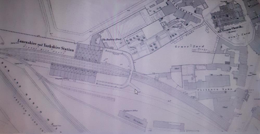
Photo: Peter Walsh
Item #: 34243
Quite fascinating as to how this area of King St West/ Hallgate and Dorning St has changed over the years, I'd never been told and the people I'd known had probably never heard either that the church yard had been so extensive. I was then wondering if where the railway had cut through that possibly was the site of the Wigan Plague Pits, maybe or maybe not, because in 2020 Jo Anne had started an interesting discussion on Communicate about a Plague Pit at the rear of All Saints/ Wigan parish church. https://www.wiganworld.co.uk/communicate/mb_message.php?opt=f1&opt2=&msd=1454590&offset=0&subject=Plague%20Victims%20in%20Wigan
There would most likely have been others too and in the 14th century would have been hastily dug outside the alleged wall for the commoners, but obviously the sites have been lost through the ages.
Thanks for the info on Woodhouse Lane too Jo Anne, I'd always wondered how that name came about, and had wrongly assumed it came about with the prefabs that were once along there.
Judging from this map, the major disturbance to the churchyard was when King Street West was cut through. That doesn't seem to have been carried out as part of the erection of the station as seen here.
Cyril I believe victims of the plague were buried on the north side of the church and there is a plaque in the King of Prussias yard on Hallgate regarding this
Rev David. The railway lines appear to clip the bottom of the graveyard, but where was the graveyard boundry before the station was built. Also
there is a noticable lack of tombs marked for such a large area. We need a pre railway map.