Wigan Album
Ince
5 Comments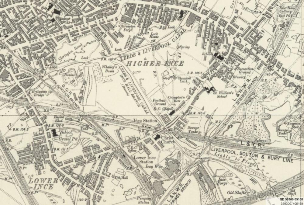
Photo: Rev David Long
Item #: 33656
Interesting to see that there's an RC Chapel nearby - and St William's School further up - but no St William's Church.
As Mick often says on photo-a-day, "I can see our house on here"....I actually CAN see the house where I was born and grew up! It's just to the right of the word "Green" in Ince Green Lane. The row went off at a slight tangent to the lane.
Our house was next to St. William's Church when I was born in 1952, but the church hadn't always been there. It used to be further down in The Viaducts area, I believe.
Mick will still be saying that when he moves to London Irene, unless of course he's having everyone on about moving to there. I never knew there was a canal branch along there and have always known it to be solid ground, though there is a Canal street and also an archway in the road bridge where the canal flowed under as seen on the map, did the barges carry chemicals to and from the works which was once there or was it coal to the iron works, or maybe both.
??? ????
I also remember The Conquering Hero pub known locally as 'The Conq' that was at one time below the bridge and which leaned backwards badly with subsidence, maybe the foundations had slipped back into where the canal had been backfilled at the rear of there, was it demolished or did it collapse.
I believe that St.William's original Chapel building was near Consort Street,near to the Conquering Hero pub.