Wigan Album
Westwood
9 Comments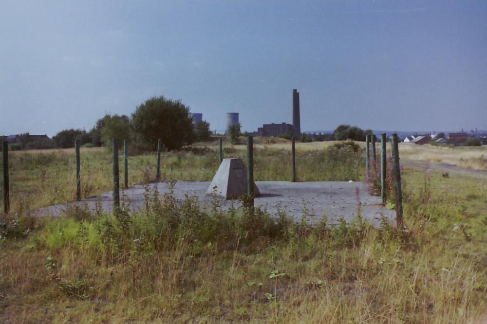
Photo: terry almond
Item #: 24691
Is that capped pit shaft part of Ince Moss Collieries?
Most likely Loz, Ince Moss pits were the only pits in the locality of Lower Ince, especially within that range of Westwood Power Station. Looking at the capping, and the depth of those shafts', did the filling only go down to a certain depth of the shaft, or were they filled from the bottom, to the top?
Albert - it's not the only capped shaft to be found in Lower Ince - you've forgotten the cap at the junction of Banner and Deakin Streets for Crow Orchard Pit, for which the branch off the main line via Eaton Terrace was made. The other shaft was at the back of the garage on Westwood Lane, and its top brickwork was exposed when the site was cleared for the new houses - it was recapped, and is under the gardens between the houses - so the new houses on Deakin Street have a capped shaft in front of their houses and behind.
I'll try and find my pic of the exposed shaft top.
Filled with a mixture of stone chippings and pit dirt these days, from the bottom to the top, usually by a conveyer belt. Shaft fillings have been known to settle and form voids, which can be rather inconvenient.
Thank you Reverend for this input. Do you have any further knowledge regarding the filling in of the shafts, appertaining to the furtherance of my previous comment, and the geological safety measures surrounding such deep shafts.
Thank you Loz, for your input, on the question I posed
Locals told me that the shafts were usually bridged with timbers, with no infilling. I've got pics of a crew arriving on Westwood Lane to test if a depression which appeared in the grass verge was indicative of unknown shaft. (It wasn't) They showed me their map of known local shafts, dotted all around the area - mostly shallow, but presumably with the potential to collapse in on themselves at some stage. One was only yards away, but there was no visible sign of it, then.
Later pictures show that this pit shaft was near the Wigan Flight, to the north of Fosters Playing Fields. I also think you can see the fence posts around the shaft in the left mid-background of the previous pic of the lock.
On Friday 12th April, I visited the location of the capped pit shaft shown in the photograph. The area is now under trees and covered in undergrowth in what is now part of the nature reserve around Whalley's basin. There is no remaining sign of the concrete plinth or base at the exact location found using old online maps and my phone's GPS. In fact, there are no visible relics of any collieries having been located in the general area. I was however rewarded by the sight of two adult deer running through the woodland.