Wigan Album
Derby Street
14 Comments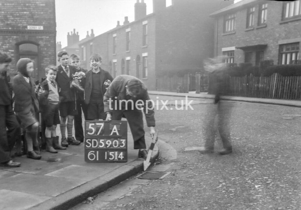
Photo: Veronica B
Item #: 35025
According to Wiganworld stuff street index,it was off Beaconsfield Street,Whelley.
Sorry,there is another Derby Street,off Pearson Street,Lower Ince on the directory.
Lots of boys used to wear those knitted balaclavas.... I think I was told it was so they didnt get earache ! A couple of them have hardwearing clogs on. Veronica & bet they were the Derby St Gang !
Derby St . still exists Veronica in Spring View , as do the terraced houses , although the school appears to have been recently flattened .
It runs parallel with Warrington road at the bottom of Pearson St. and Darnhall St.
Derby st Spring View
Sorry ! …. Pearson St . now appears to be called Repton Ave .
I think it's in Spring View, Veronica, but am happy to stand corrected. I love the little lad with the clogs and the balaclava!
It looks like the big lads have been playing ‘footie’ . I seem to recognise the tall lad he does look familiar.
I agree it could be Spring View as well I did look on ‘streets’ on WW. This is why this is such a good site. ( apart from the disagreements!) ;o))
The tall house in the background could be on the corner of Warrington Rd and Spring St.
Pearson Street was opposite to Cecil Street. I played under 17’s rugby at the Spring View school playing field which was at the bottom of Repton Avenue.
They are outside number 2 Derby Street, Ince, at it's junction with Repton Avenue.
It's not the Derby Street in Whelley, that was my play ground, it was cobbled.
This is Derby Street at Spring View (Lower Ince).
Note: The Ordnance Survey location boards always give the map reference (coordinates) as: sheet no. followed by kilometre grid square corner X,Y followed by x-increment of the square (in tenths of a square = 100 metres) then the y-increment. So in this case: map ref. SD 595 037
Use the NLS website to find a map of the right scale and date to find the location of the photo. I used map sheet SD50SE - A, published: 1956.
C c can anyone else s s see a g g ghost?