Wigan Album
Hindley
6 Comments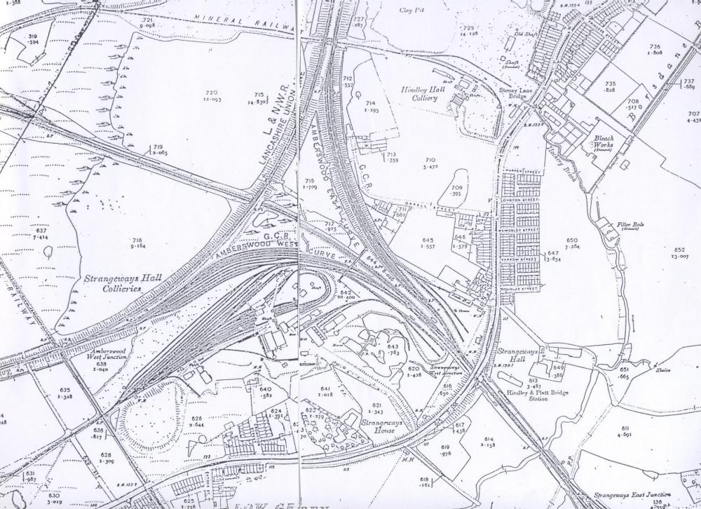
Photo: wes knight
Item #: 8229
hello brian there is a referance to stoney lane top right and low green very bottom if its any use, thats all i have that direction, i have a town directory with slackey fold 1925.
The map loks a copy of part of "The 25inch Map of Lancashire Disk 3- Liverpool and Southwest Lancashire.
3 maps were produced between 1888 and 1893. The maps were drawn to a scale of 1 to 2500 (approx 25 inches to the mile)
Stoney Lane was the old name for Liverpool Road
See what's left of this on Google Earth... 'Amberswood Lake'
at 53°31'43.79"N 2°35'26.26"W.
Robin
Can anyone please tell me where was 225 Liverpool Rd in 1901 and was it a house or a hospital?
Carol,225 Liverpool rd was a mid terraced 2up 2down house.These houses were built for either miners or for the navvies who helped build the railways.