Wigan Album
Wallgate
9 Comments
Photo: . Ozymandias .
Item #: 28970
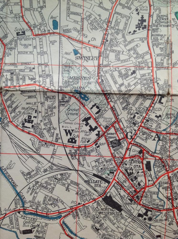
It wasn't before 1953, because the Thomas Linacre is on the map, which opened in 1953.
There was a works in Pottery Road, opposite the Ambulance Station, in the late fifties, I don't know as to whether it was in existence when this map was produced.
I also remember another building in Pottery Road, on the same side, as the bus garages. A food storage warehouse, for Wall's foods. Late fifties.
This plan appears to show Ashland avenue linking Freckleton St. with Swinley St. I don't know if this was ever the case, but it certainly isn't the case nowadays. Also , the site marked as Welfare Home in Frog lane. Would this be the more acceptable terminology for Workhouse ?
the building opposite the ambulance station was pecks tarpaulins
Vulcanite was the works opposite the ambulance station. Pecks was further up.
This is the map issued by Georaphia for Wigan Corporation showing the bus routes in red. I think this is the map from the mid-60s before the one-way debacle in the town centre.
I think 1963 or 64 because Central Station closed in 1964 abd that is shown.