Wigan Album
Golborne
6 Comments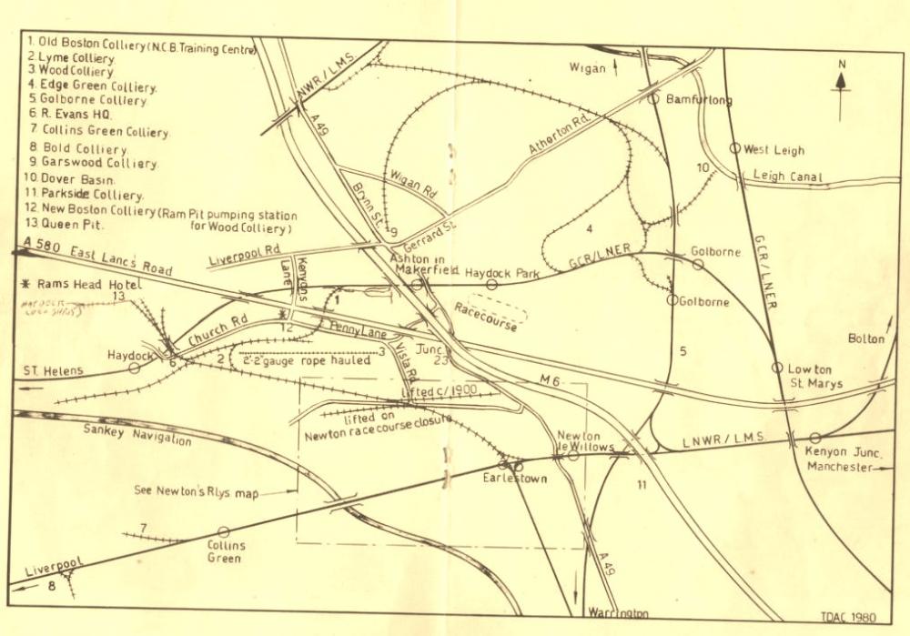
Photo: Brian Thilwind
Item #: 25229
This map is later than 1934 as it shows the East Lancs. road.
From Wikipedia:-
The A580 (Liverpool-East Lancashire Road) is the United Kingdom's first purpose-built intercity highway. The road, which was officially opened by King George V on 18 July 1934, links Walton in Liverpool to Salford near Manchester. It remains a primary A road in England and is known colloquially as the "East Lancs Road".
Contents [hide]
It also shows the M6 motorway.
I would estimate the year of this map to be 1980.
This estimate has nothing to do with the Darwin the bottom right corner :)
This is a roughly drewn map, the scale is all wrong.
I think Wigan Road should be Bryn Road, Atherton Road should be Bolton Road, Bryn Street could be correct but it is far too long, more likely Wigan Road.
Yes Kenee your right when you look all round the map nothing looks to scale, if you look at the rail line far right that is now the Leigh bye pass it goes to near to Bamforlong, but it shows how much railway lines we had around this area never to come back.
I would say this shows the amount of rail around the area about the mid 1960s, M6 opened 1963 ish and most on the lines were gone by 1980,