Photos of Wigan
Photos of Wigan
Album Contents
Album Contents
Wigan Album
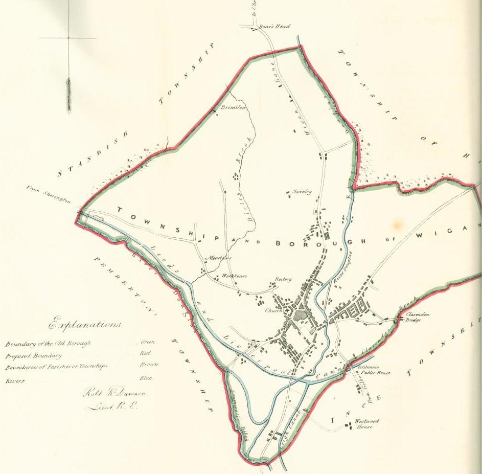
1832 Wigan Boundary Map
1 Comment
1832 Wigan Boundary Map
Photo: Keith
Photo: Keith
Views: 5,339
Item #: 23381
Item #: 23381
The 1832 boundary map of Wigan. Standishgate, Hallgate, Wallgate, Queen Street, the Parish Church, the Workhouse, the Meadows, Swinley, Boar's Head, the Britannia Public House are some of the name places on it. Pemberton Township, Haigh, Ince and Standish are all outside the Wigan boundary and the proposed one.
Comment by: Albert. on 3rd May 2013 at 14:55
Someone will correct me if I am wrong. The intervening years between 1832, and the time when Wigan became a Metropolitan Borough, the boundaries of the borough remained relatively unchanged, except that Pemberton later became Wigan Borough, up to the Orrell boundary, (I know not when). Since becoming a Metropolitan Borough, have these boundaries altered?. I notice when Ince, Leigh, Hindley, Platt Bridge, etc. are mentioned, they are referred to as Wigan.
Leave a comment?