Wigan Album
higher ince
14 Comments
Photo: josie pennington nee beckett
Item #: 19486
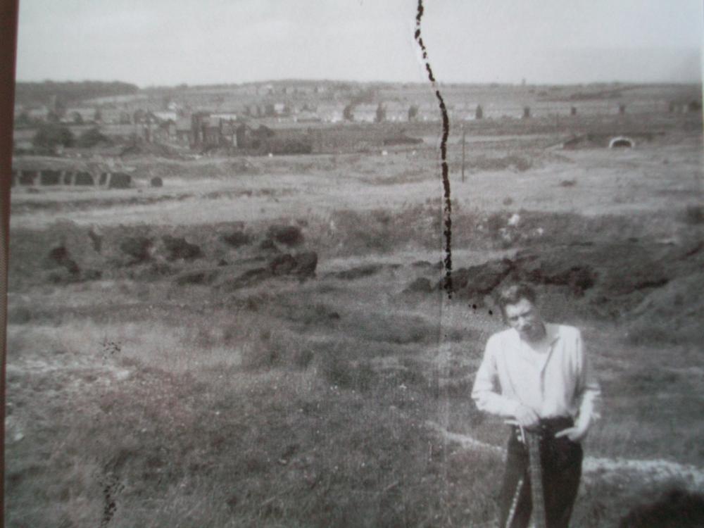
that is stoney bridge cale lane across top kirkless hall also in pic
yep
they look like the houses in cale lane
am trying to make out the strustures on the left of the picture
oh my god, thanks johny be good, i allways thought it was hr ince or is it ince and new springs in back ground ? our ray looks like johny be good ha.
its very interesting this pic as just a few weeks ago i was up lane looking back on my childhood and myself and my hubby and cousin gerry went for a walk up belle green lane going up canal and ending up sort of near hindley golf cource but i have to say in ince part where i think this pic was taken well it was soooooooooo overgrown you couldnt see owt , why have they planted trees and stuff there theres no views there now it was better all open like in the pic .
cant see kirkless please help.
Ive just had a shufti on google earth, and the building to the left seems to me to be on Farm Lane which leads to Kirkless lane,I cant make out many details but it seems to be at the Ince end of Redland tile works, maybe it is the farm of the farm lane in question, its definitly Cale lane in the background, but I cant see the Kirkless pub, or even the Commercial, which should be visible, needs a person to venture to the top of the rabbit rocks to have a look
Josie you are stood at beginning of rabs with the rabs behind you coming form Belle Green Lane. Bridge is the black pipe stone bridge over canal on Kirkless Lane and Kirkless Hall buildings to the left. Long row of houses is Cale Lane and houses in distance are at top of brow at new Springs. Haigh Hall trees in far left distance. The brick columns were on top of the land at the side of the canal lock which was third up after iron bridge. The flooded pond at the bottom of the rabs now would be to the left and downhill from the brick structures. Kirkless workshops and pubs would be out of picture right and uphill. In about 1965 they started to build the estate which on here is a field from Kirkless Hall to the houses in Cale Lane. Tile works slightly to right from canal bridge out of picture.
Us toplockers always called it little rock.played on it as kids.one side easy to climb but we had to the top by the difficult route. happy days
The large building top left looks to be Kirkless Hall, remember being there in the early 1980s locating a septic tank that was in what was the filled in moat, when the then owners were digging down they found an old flintlock pistol, quite rusty and corroded but still recognisable and quite a few shot balls, I always wondered if they dated back to the civil war and was hidden there by someone and then forgotten about.
If this is the expanse,at the extreme end of a street,named Tank Street. At the end of the 1939/45 war, this was a massive rubber dump. It covered many acres. It was right at the top of Belle Green Lane.
thanks everyone,and albert yes this would be near tank st, we lived in york st at top of lane and i remember the rubber dump .
Hi first time i have visited Wigan World, I am looking into the history of my family. I would be interested if anyone has any photos of the area at the top of Belle Green Lane. There is two houses (use to be Belle Vue Hotel) Tank Street that comes up in childhood stories, please can anyone help me
hi rita,whats your family name,the houses you mention are still there (belle view)think there are some pics on here that may just show it, I will try and find something x
hi rita i lived in tank st many years ago .the two red brick houses you mention had the todd family in one and the aspinal family in the other.