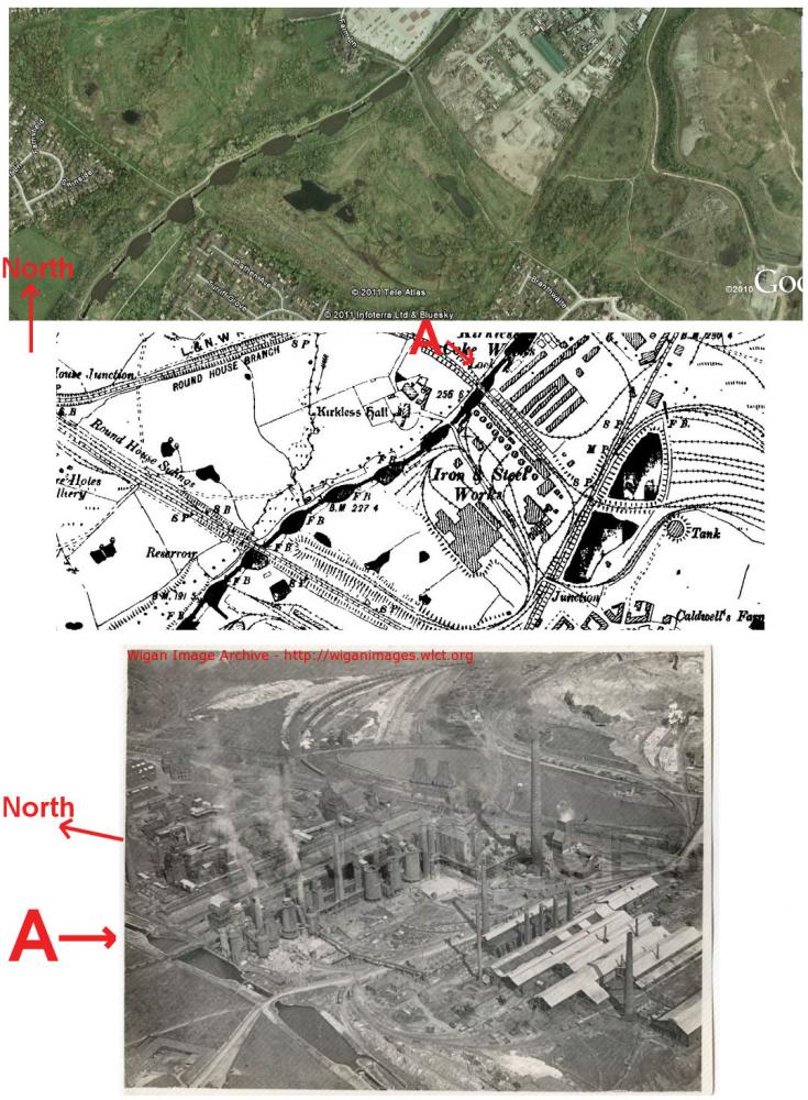
Wigan Album
Kirkless Colliery & Iron Works
8 Comments
Photo: Ian Hanna
Item #: 17321
The hook of the 'J' shape on the maps is the whelley loop line which goes around what is now the rabbit rocks. Hope this helps to clear this up?
thats better!
Kirkless Hall Farm on all three views
Sorry, but I can't see the Whelley loop line... I can see a railway line crossing the canal, but it's not the Whelley line.
Thanks for correcting me, glad you have put this on to show me exact location.
site of whelley loop line is on top photo and on map but not on bottom photo
railway bridge to which you refer was the Roundhouse Branch off the Whelley Loop Line - I can remember the abutments for this bridge but never saw this bridge in place or infact a photo of it if anyone has one....
i posted a map of this area,look on places under higher ince
I've got you Scholes Malc, I understant the map now thanks to you. The railway line and bridge that crosses the canal in the black and white photo, am I right in saying, what was once or still is opposite Redland tiles just out of the pic?
The "Rabbit Rocks" are to the south of the black and white picture. A railway line used to run from the east side of the photo as you look at it and went under a small bridge that is just visible on the middle right hand of the photo.
A walkway runs from the canal bridge through the site to that bridge.
If you cross that bridge and went east you would come to the top of Belle Green Lane.
The railway that went under the small bridge went under another bridge where the Whelley Loop Line crossed it after going along the south side of the "Rabbit
Rocks".
The Whelley Loop Line then crossed Belle Green Lane near to where the Bush Hotel is.
The railway line that ran from the Iron Works under the small bridge and then under the Whelley Loop Line then ran behind the terraced houses of Belle Green Lane on the same side as is West Street today.
The line then crossed Belle Green Lane to the rear of what is now West Street and opposite Nelson Drive and then ran behind my Grandfather`s (John or "Jack" Sudworth) house 154, Belle Green Lane that was joined to the Oak Tree Public House by a small covered alley.
The terraced house on the other side of 154 was occupied when I was a very small child by Mrs. Riley.
I think that Mrs. Riley`s was the last house before the "Crossing".
I was born in 1960 and spent most of my early childhood at 154 Belle Green Lane when my parents were at work.
I do not remember seeing the "Crossing" as I think it was gone before I was born.
The railway fence was the boundary fence to the back yard of 154 as far as I remember.
The picture shows the spur to the iron works and where the loop line crosses a few locks further down. This spur starts at the corner of camberwell cres and goes directly to the iron works. The signal box used to be at the junction when i moved here in the early 70s tho out of use. Part of the loop line is now part of the national cycle network and path to cannon sharples school.
Cheers colin h