Wigan Album
Lower Ince
8 Comments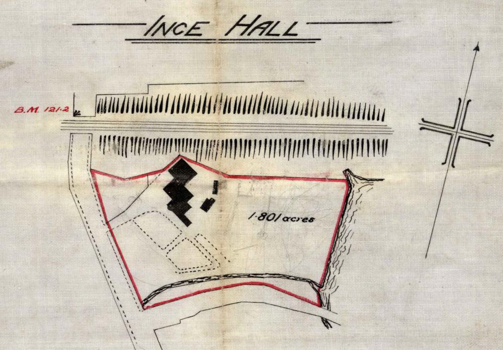
Photo: Rev David Long
Item #: 13677
i think i know where this is, laycocks is on the other side of the line going to wigan, the hidden detail lines on the map could these be previous existing buildings, are all the photos posted the same hall? great photos
I think the lane at the side is locally called the 'Donkey Lane'
where did it actually stand,was it near westwood cemitary?
It was opposite the former St Mary's Schools - my Vicarage is on part of the school site, and St Mary's Church is now in one of the school buildings. Next door, to the South, is Lower Ince Cemetery. Westwood Cemetery is at the top of Westwood Lane, which goes off due West just the other side of the railway bridge. The lane at the bottom is indeed stillknown as Donkey Lane.
thanks david for that information i live in spring view three doors from mrs batch who i know allways attends st marys well shes not to well at the moment , so i know now where u mean i cant ever remember the hall ,sad its gone
Rev Long... I have posted a section of the OS map of 1929 of the area in the Album - Places - Lower Ince.
It wasa opposite the school, and my grandmother lived in a part of it. I travelled from Platt Bridge to have lunch with my gran every school day. It was brilliant to play in the gardens, sunken,- stream , a railway line, putting green and a strawberry patch
My family moved into part of the hall in the early 1940s i was born there in 1943. Rev. S. Bryson and later Rev.J.Bebb lived in the middle section which was the vicarage.I was baptized at St.Mary's, my brothers and sister went to St. Mary's school.