Wigan Album
Mining
7 Comments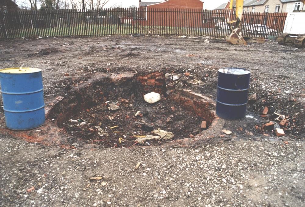
Photo: Rev David Long
Item #: 24759
This pic shows the top of the shaft before a concrete cap was cast around it.
Beyond the fence you can just make out the triangular concrete cap for the other shaft on the spare ground at the ends of Banner and Deakin Streets.
Reverend. Having seen in todays press, the large sink hole that appeared in a garden in Bucks, it does cause you to have misgivings, especially with the very adverse weather that seems to be constantly with us, making the earth so sodden.
Where the digger and fence are in the pic,there is now a row of houses, so that means that this shaft is in someones back garden. The concrete cap on the other shaft can clearly be seen today. The pit was sunk around 1820 and at one time was owned by two brothers named Hilton. There is a Hilton St nearby.
It's not the holes they know about, Albert - it's the unmapped ones. In an area like Wigan, where coal is found quite near the surface, one of the earliest coal-getting methods was to dig a bottle pit. That simply meant digging a hole down until the coal was reached, and then scooping out as much as you dared from the area around the shaft (or neck), thus forming an unsupported bottle-shaped void. Then you'd move onto the next area - putting a few planks and some sods over the previous hole. Few records were kept of such workings - so they could be almost anywhere....
think it was called a bell pit rev
You're right, cliff - it's just the image I have in my mind is of an old-fashioned bottle, with a broad base.
Does anyone know when this colliery was closed, and when the shaft was filled in?
Looking at the Coal Authority Interactive Viewer I believe the two shafts mentioned are known as Crow Orchard pit and Crow Orchard Shaft , although which is which I am not sure.