Wigan Album
Ince
14 Comments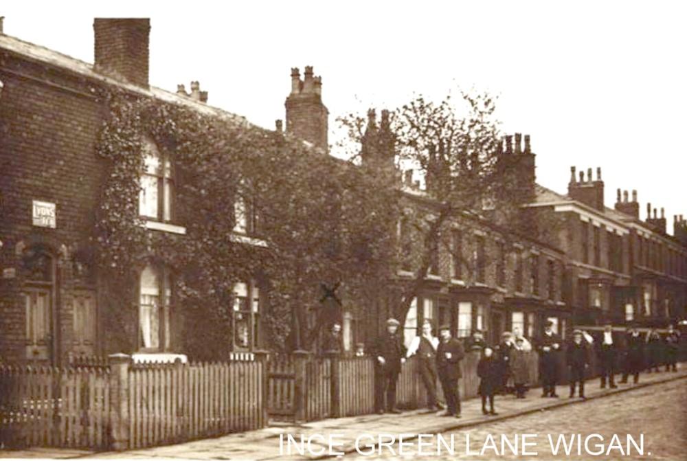
Photo: RON HUNT
Item #: 32564
A pleasant street. Wonder if the x in the centre of the photo denotes someones house ?
Each time I open this item a green tinge appears in the climbers then my easy grasp of the enamel sign tells me that this is nothing to worry about. I like the all-important X inscription, and the garb without a coat. But why are these people so arranged I wonder.
I think they may have been waiting for the walking-day procession, Philip. And not many cameras about then so if they saw a man setting up a camera , probably on a tripod back then, all eyes would be turned to him.
Only just noticed the old tin LYONS TEA advert on the wall of the house?
It could well be about a hundred years ago when this group of people were standing at the side of the road. Good picture, Ron
I do believe in later years, the Council Offices were opposite, and also the clinic.
I see what you mean Irene. And the man with the camera appears to have been in an unusual position - the middle of the road.
Yes,Ince Public Hall was on opposite side of road,a bit further up (now a nursery) and the clinic was directly opposite.
Ince Green Lane is in Ince.
When this pic was last put up in January, I argued that it wasn't the row opposite the Public Hall - because there's a terrace there with a colonnade, and in mock-Tudor style, called Woodlands, which was built in 1918. I said then that it's at the bottom of the Lane - near the Black Diamond - and that the nearer terrace has been demolished.
You're right, Rev, now I study it. It IS further down towards The Black Diamond.
The houses at this end of the Lane suffered from mining subsidence - the row behind the photographer had its frontage completely taken down and rebuilt. The first terraced row (nos. 320-310)were probably too far gone to save - and if you look at Goggle Earth you'll see that the end of the first house (308) is new brick, and the roofs of that pair of houses and the next pair, have been replaced with pitched roofs, rather than the original apex roofs.
Just been past there is a number on one of the houses date 1918.
Owd Viewer - that's the terrace opposite the Public Hall - the white buildings. The terrace leading off the pic here has a plate for Anderton Terrace 1869, just before the corner with Sharp Street.