Wigan Album
Aerial Flights
7 Comments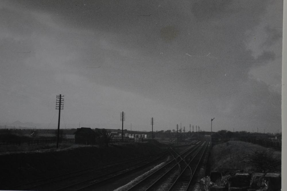
Photo: Mike Featherstone
Item #: 31990
To get a panoramic view... photocopy this picture 31990 and 31991 and add them together. They were taken a few yards apart so do not match exactly but you can line the clouds up and the white building. This makes the railway and its position to the coal tip more clearly visible. Footnote: An " Aerial Flight" was a overhead cable tramway with buckets that took colliery waste from pit to tip.( Like a modern ski chair lift.) They were used a lot in the North East pits where they tipped the coal waste into the sea. I always wondered how this tip obtained its name. There was never any evidence of original "Aerial Flight" equipment (tower bases etc.) it was perhaps dismantled and either reused elsewhere or scrapped. Any info anyone?
The bridge where I took this photograph used to carry another railway ! Starting from the south at Engine Pit (1880-1910 John Scowcroft & Co Ltd.) This pit was previously named Close Lane Colliery and was about half a mile away from the back of where Turner Bros Asbestos Factory was to stand. This railway then went north, a left hand branch joining the main line shown in the photo. (L&NWR Eccles, Tyldesley & Wigan Line) Continuing on over the bridge it linked up with Hindley Green Colliery (Spring Pits) (1865-1930 John Scowcroft & Co Ltd.) Before reaching this Colliery another branch line curved off left passing south of Scowcroft farm and passing north of the land which became "The Aerial Flights" and the existing lower slag heap. The next destination was Grammar Pit (1880-1910 John Scowcroft & co Ltd.) The line then continued right up to Atherton Road where there was a coal yard. This yard stood next to Sandringham Road.(Where the two detached houses now stand on Atherton Road) This Railway had yet another branch, before reaching Grammar Pit this headed off left across the top of Leyland Park and joined the main line that headed for Hindley South station. (L&NWR Hindley Junction Branch) Grange Colliery (1901-1925 Crompton Shawcroft Ltd. had a connecting line that also joined.
For a brilliant picture of this line in action, on the other side of the bridge, go to Assorted- Railway- Picture 42968 by Thomas Sutch.
To view location of John Scowcroft & Co Hindley Green Colliery go to Assorted-War Related Items. Scowcrofts Cotton Dump. Taken in 1947 by Eric Turner from top of Aerial Flights.
"Coal waggons were hauled along tracks to a sale yard almost opposite Barlows Nursery. Here the coal merchants filled bags with one hundred weight of coal for delivery to houses in the area." "On our way down Scowcroft Street we went on cycles to Hindley and Abram Grammar School and crossed the Railway line that led to Atherton Road Sales Yard" "Maple Avenue was formally called Scowcroft Street, a sign that this once led to Scowcroft Coal Mine. From this coal mine waste was carried in huge tubs by overhead wire system that had a bar to catch a lever on the tubs to cause the tub to let the waste drop out. In time huge cone-shaped heaps were formed" Extracts taken from" Memories of Hindley Green" by Fred Hardman. On St John,s Hindley Green website. Note : If the Aerial Flight system was moved from time to time a series of cones would join together to make the long bit of our "Aerial Flight. Thanks Fred, mystery solved !
The two disused sets of rails on the left of the main line were "Scowcroft Sidings" Ref: 1906 O.S. map.