Wigan Album
Aerial Flights
2 Comments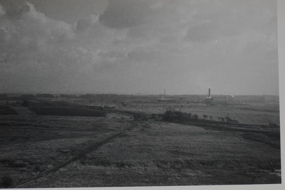
Photo: Mike Featherstone
Item #: 31985
The dirt road running across the picture was Close Lane. This started, as it does now, off Park Road alongside Hindley Grammar School. It then wound its way through the countryside until the first junction.(This stretch was known as the "Seven Turnings") At this junction Close Lane turned left. Straight on passed the "Maggot Farm" then over two railway bridges (Still there) heading towards Bickershaw Lane. Turning right would lead back to Grammar Pit along the existing low slagheap. Taking its left turn Close Lane passed the north side of Scowcroft Farm before turning right ,along the end of this building, this also took it passed the end of the "aerial Flights when the tip was there. The road carried on, as you see in the photo, over a railway bridge then along Turner Bros rear fence. At its final end it joined Coal Pit Lane. Coal Pit Lane started at Leigh road, just above Bickershaw Lane and led to Close Lane Colliery (Later named Engine Pit when reopened by John Scowcroft & Co). Coal Pit lane is now a very short cul de sac and unnamed. The Colliery would have been to the right of the picture. I remember small slagheaps around there. In the days of horse and cart transport Close Lane was a short route from Hindley to Leigh !
Correction : Coal Pit Lane joined Leigh Road just above the junction with Smiths Lane, which of course then becomes Bickershaw Lane.