Wigan Album
OLD MAPS
3 Comments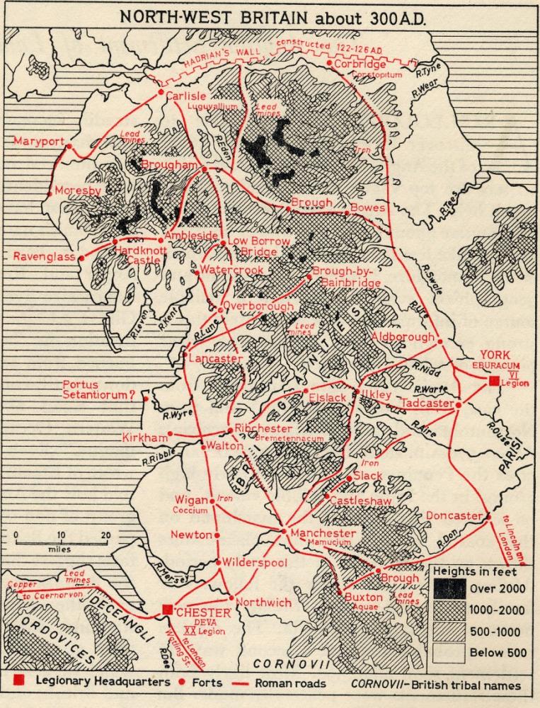
Photo: RON HUNT
Item #: 24475
It is interesting to see, how straight the Roman roads seem to be. I was once told that if there was a tree obstructing, the Romans' would cut it down, whereas the Anglo Saxons' would go round it. How true that is, I do not know. Seems logical, when you take a considered observation of ancient roads.
Interesting Albert, I've read that the Romans mainly built on existing pre-Roman routes, i.e. "improved" them, suggesting that probably the roads were fairly straight before they invaded. Revisionary historical "facts" I suppose are always undergoing changes of emphasis.
A fasinating map, can I copy it ? I read somewhere that the way Romans built roads was, a scout would go ahead to a high point that was visable to the road builders he had left behind, he would then keep a beacon burning & the road would be built in a straight line towards the beacon, a road could be built at great speed for troops to march along & made better at a later date. I love looking for Roman roads on modern day maps...they are still there , the Fosse Way, Akeman St, Watling St, Ermine St to name a few.
A trilogy by Rosemary Sutcliffe is worth reading if you are interested in the Romans in Britain, 'Eagle of the Ninth'