Wigan Album
Douglas Valley
10 Comments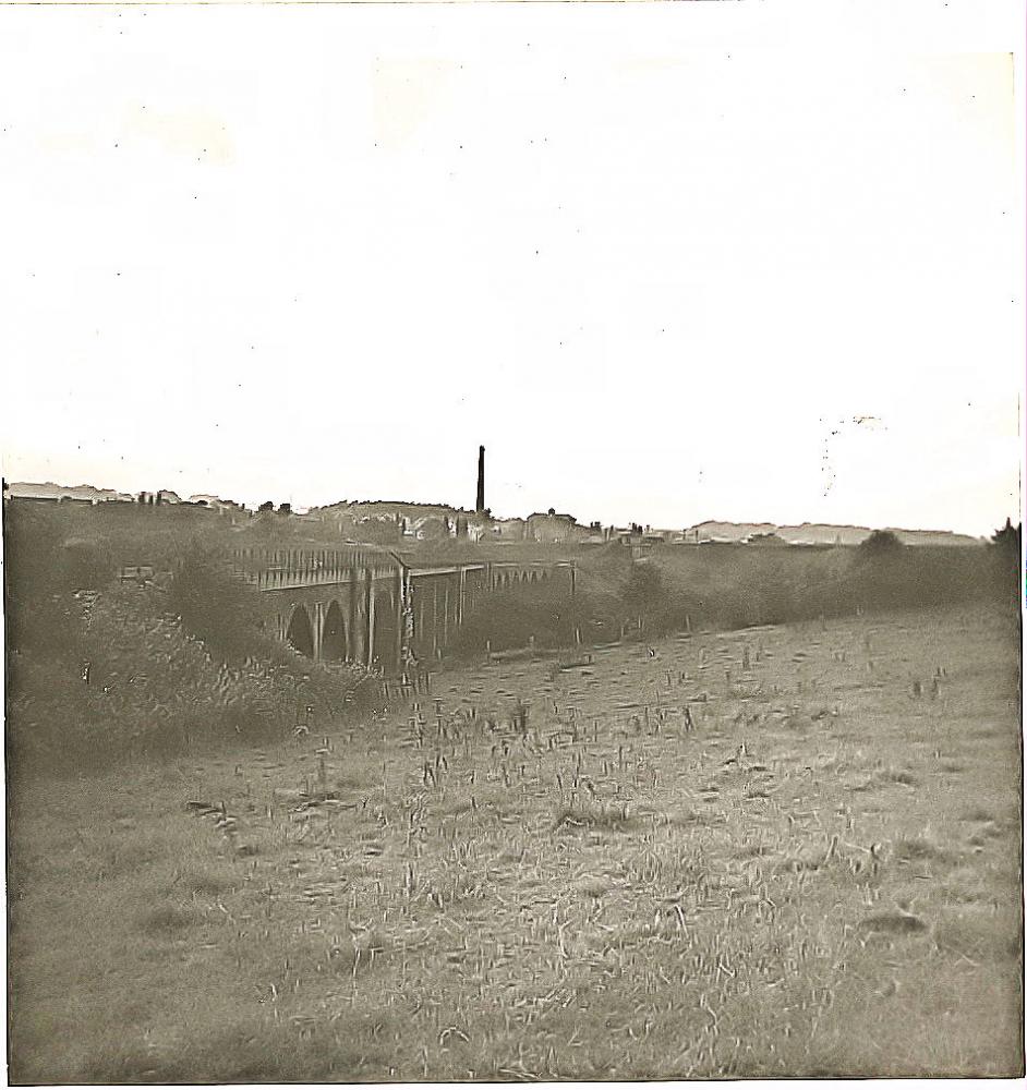
Photo: Barrie
Item #: 30678
Always use to count tham steps when we was kids.still do with the grandkids think there is 65 now cheers for that Barrie.
Nostalgic photo, I think the chimney could be the Victoria colliery rather than the bleachworks
AB, Trying to remember from 55 years ago,I had forgotten that Victoria Pit did have a tall chimney and you could be possibly right about it. Having looked at the photo and comparing to the old OS maps on the net for that era, the line of sight seems to head towards Victoria and not the Bleachworks.
The chimney does appear to belong to Victoria pit as the engine house is visible to the right of the chimney. Both headgears seem to be missing so its probable they were taken down pre 1963. The Whelley Loop ran towards Standish over Chorley Road via an iron bridge which was demolsished in 1984, Travelling further along the line it snaked its way past the north end of Vic Pit No1 tower and joined up with the WCML just before what was Standish Junction at the bottom of Rectory Lane. The Bleachworks, whose chimney survived until 2004 was to the right of the main line as you travel towards Preston. I think this is how I remember it
There was a higher viaduct to the left beyond the one shown. I walked over this in the late 60's. You could look straight down through gaps to the river below. Does anyone know where this came from or went to?
The Boars Head viaduct also spanned the river Douglas for the old line to Blackburn via Red Rock.
Thank you Stan disher. I now remember that it branched off the 6rmain line at the Boars Head and that the line passed close to the canal at red rock. I am sure the viaduct supports are still there
Philip, we used to call the higher viaduct the 7 bridges, the lower one was known as the 20 bridges. If you go on album, then places, and scroll down to whelley loop line viaducts, there is a photograph of the supports.
Folks, on Places-Douglas Valley #15672 photo shows this viaduct and the higher one at right angles to it. In mine you can just see in the distance the start of the higher one. Something I didn't notice before. I had a schoolboy friend who used to live at the old saw mill on Chorley Road and we roamed all round there in late 50's.Memories of a bygone age.
Philip;the :dominoes:are still standing.walk along pendlebury lane under the arch of the viaduct,turn directly left down to the douglas follow the path the dominoes will appear amongst the trees