Wigan Album
Westwood
13 Comments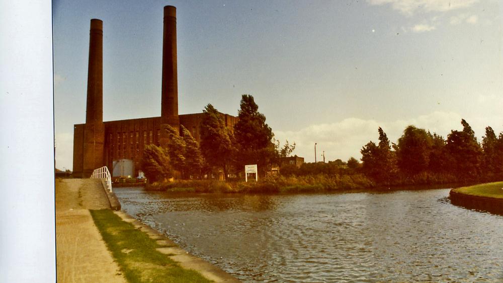
Photo: Maurice.
Item #: 29063
So Maurice, when did they put in the metal footbridge across to Bithell's yard, any idea ? Would it have been around about the same time that they rebuilt Henhurst bridge ?
On the far corner is where a row of terraced houses called Ormandys houses stood. My grandad was living with his parents there in the 1911 census. Anyone know when they were demolished?
I seem to recollect, somewhere in Ince, there was a row of houses, locally known as the Kay's hases. Does anyone know where they were located?.
Albert - Kays Houses faced the rear perimeter fence of the power station - and were accessible via the tunnel under the WCML at the end of Richard Street, off Warrington Road, or via the track from the end of Westwood Lane, which I think was still called Westwood Lane, with its far end giving onto Poolstock, as Westwood Road, after crossing the Leigh Branch of the L&L on a swing bridge. Lots of pics of them under Lower Ince and Westwood here in the Album.
Thank you Reverend. Passed by them on many an occasion, taking a short cut over to Poolstock, but the actual name that related to those houses, escaped me, until reminded.
Hi Ozy,I thought the footbridge had been there quite a bit longer than the new road bridge,but I don't know if it was,it's smelly when you use it though.
Albert,top of Westwood Lane,over Bridge look to right over Field towards Power Station , in front of Power Station stood Kay's House's.Most of them were on my Paper Round.A long cold walk on a Dark Winter Morning.
Jimmy. I took out newspapers for Mason's, of Warrington Road, Lower Ince, near the Swan Hotel, 1947 to January, 1949. Previous to that, I took them out for Tatum's. A good mate of mine, (May he R.I.P) took them out for Jinny Nevin.
Albert,worked at one near Swan,moved to one bottom of Ince Green Lane on Warrington Rd more money.cant re member his name.one Son was a Police Officer. 10/- for 6 mornings 6 nights.Football Pink on Satufday night. Paid 5/- for a Sunday morning.i did every Sunday.
Gordon, gaffer has put a map on a discussion thread (link below) showing Ormandy's Houses, you may well have seen it before. Copy and paste the link into your browser bar.
http://www.wiganworld.co.uk/communicate/mb_message.php?opt=f2&opt2=my&msd=272859&offset=0&subject=Turn%20Bridge
Cyril, yes thanks, I have seen this map. Though there seems to be about 20 terraced houses my grandparents lived at no 31. It seems many of the houses seem to be split in two. Indeed the census just lists only one habitable room. Must have been quite a crush for a family of seven.
Westwood Power station was demolished in 1989. I remember watching the cooling towers, and the less spectacular chimneys being destroyed. Girobank offices were built on the site, and even that was only to be there for about 20 years, as a new building is there.
My Great Grandfather also lived in Ormandy's houses on the 1881&1891 census's. Anyone got a photo? Thanks for the map showing where and what they were.