Wigan Album
Highfield
10 Comments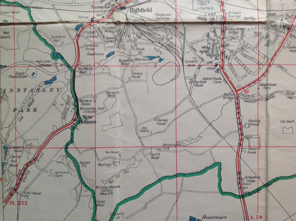
Photo: . Ozymandias .
Item #: 28908
I think that bridge went in the 1950's.
The abutments remained either side of the A49 for much of 1960's. ie Until road was made dual carriageway, but actual bridge had been removed.
The part of the line that ran to Norley Hall Colliery is no longer shown on map, if that helps in any way to date it.
Must be 64-65 Maris ave is on the map.
I know that Pemberton colliery became defunct pre 1969 although precisely when, I'm not sure.
I see it shows the pond where the Venture is located now, I believe a young boy drowned there years ago and was fenced off. It doesn't show the ventilation shaft on the opposite corner of the venture though.
I have a copy of the same map and it is dated 1953
The red lines are the bus routes with the route number on.
ie. no 10 for Worsley Mesnes and 2 and 2a for Ashton.
Not sure about the other routes.
That's interesting Jim, I hadn't actually spotted that.
has anyone noticed the big green sign on the house at bottom of highfield grange ave complaining about building on green belt it looks to me that is where his house is hypocritical comes to mind
Kevin, I'm not sure it's as early as 1953. My dad grew up in the bungalow across from the BP Station near Sainsburys and he said he had an aunty that owned a farm that was in the little courtyard of houses next to Yates's chippy. He used to go onto the fields and feed the horses at the back, where Ruskin etc is now. I'll ask him how old he was then