Wigan Album
Warrington Lane
18 Comments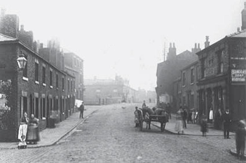
Photo: Dennis Miller
Item #: 25110
Thanks for posting Dennis - a wonderful supplement to the earlier photo you mention. I wonder if the street to the right is Orrell Street, if so then this was taken on the "boundary" of Warrington Lane and the beginning of Warrington Road and the street on the left, if I'm correct, would be Boundary Street and again, if right, then the shop you mention would have just been out of view to the left.
Ben... yes, Orrel Street to the right, Boundary Street to left.
It should read Warrington Road, Dennis.
Garry... Warrington Lane for certain, says so on the 1909 OS Map.
Warrington Road, look at street map.
What a fabulous photo - I could tell it was Britannia Bridge but never new it like that and look at the cobbles - bet they are still there under the tarmac.
Whatever you say Bro... :-)
Nearly completely unrecognisable compared to how it looks now. The middle building on the right is Twiss Bakery which was demolished not long ago? Wonder what it was at the time of the photo.
The building on the right with the woman stood in the doorway, also looks like a pub?
There was a pub called the Britannia Inn on the right near the bridge, the tall building on the left, next to the bridge was the Navigation pub.
Winder... The Britannia pub, and the short terrace attached to it are the only buildings still standing today from that photograph.
*sigh*... I meant the Sheperds Arms... not the Britannia! :-(
The building just in corner, where the notices' are plastered on the wall, was a barber's shop, in the early, to mid fifties. Had my haircut there on numerous occasions
Forgot to mention, Denis, an excellent photo you've put up here showing us how things used to be.
Any idea of the date?
Winder,not too sure of the date. I put c.1900 as a ballpark date, but it could very well be earlier.
thanks dennis this is one to treasurewhat a great photo
There was a pub on the right when I grew up in the 50s - the Transport Inn (Half Way House?), run by a Mr Twiss. My father used to tell a story about it being on the boundary between Wigan and Ince, who had different licencing hours. People would move from one end of the bar to the other when it got to closing time at that end (which way around was it?). I wonder if there as any truth in it?
There may have also been another pub on the left just before Britannia Bridge.