Photos of Wigan
Photos of Wigan
Album Contents
Album Contents
Wigan Album
Wigan Map circa 1850
4 Comments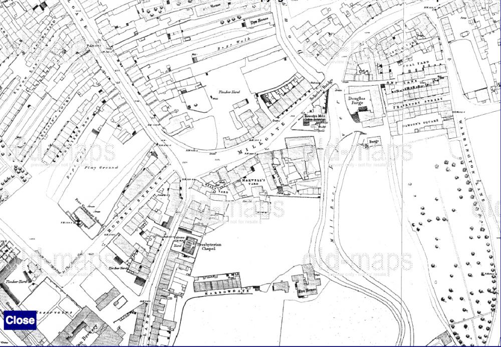
Wigan Town Centre Map circa 1850's.
Photo: Ken
Photo: Ken
Views: 6,681
Item #: 23326
Item #: 23326
An early map of the Wigan town centre, dates from around 1850's.
Comment by: Carol on 28th April 2013 at 10:00
Great map! Do you know where I could get hold of a copy of the map. I have family in 'Old Cloth Hall' , a slum area north of King street, roughly opposite the post office. I'd be interested in seeing more of that area. Thanks
Comment by: Neil Cain on 28th April 2013 at 10:56
I am pretty sure the History Shop/ Museum of Wigan Life on Library Street has this. They may be able to provide you with a copy
Comment by: Ken on 28th April 2013 at 13:36
Thanks for your reply Neil, all I could have told Carol is that it came from the internet.
Carol if the History Shop can't help you get back to me, I may be able to help
Leave a comment?