Wigan Album
CLARINGTON GROVE
5 Comments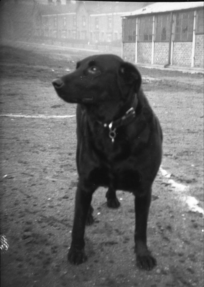
Photo: Keith
Item #: 31761
The houses seen were in Wigan Borough and the other half of the Grove was in Ince-in-Makerfield (not seen) which went down to the canal. The boundary was the culverted Clarington Brook which was responsible for undermining the foundations of several of the houses years later (including my grandmothers) which were demolished. My grandmother’s house was in the Ince District so my mother, who attended St Catharine’s Primary School in the 1920’s and 30’s, when she passed her 11+ she had to attend Hindley and Abram Grammar School rather than the Wigan High School.
The other difference was that the Wigan based houses had tarmacadam on their road, whereas the Ince road was unadopted and consisted of hard packed soil and clay. These fields are now used by the St Patricks Amateur Rugby League Football Club and apart from one house at the top end of the Grove, near Darlington Road East, all the remaining houses have been demolished.
Jock looks in much better shape than his surroundings Keith.
I remember in the 50's playing 'over the fields' we used to walk down Clarington Grove to go there. There wasn't a blade of grass at all down there., we used to jump the by-wash and rode our bikes, spending hours in the Summer months. I still have a scar on my knee, which was stitched at the Infirmary caused by falling on the shale alongside the canal. Memories you never forget.
see that very faint t just above dogs head there used to be an air raid shelter there when i was growing up from 1943 and at the top of grove was a big sign EWS on the gable end of the house and a big arrow it is darlington st east keith
forgot to mention keith i was born at no 11 harper st 1943 and was in same class as your anne at st catherines
Thanks for the correction Roy, of course it is Darlington Street East as you say and I certainly recall that unmissable EWS sign. I'll remember you to my sister when we're next in touch.