Wigan Album
Ashton
8 Comments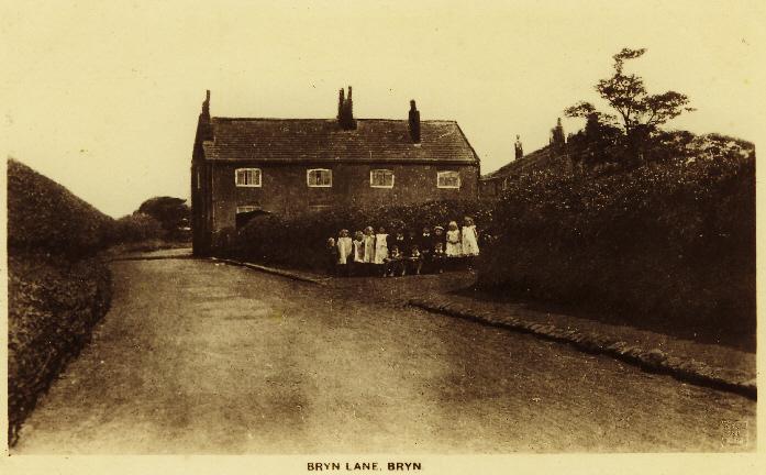
Photo: Allan Hughes
Item #: 11120
great picture Allan i don't think this is Bryn road, Bryn road had terrace houses each side in them years looks like Bryn lone as my mother called it (down landgate fields)
I think this is Bryn Road, the building was called Red Gate Farm on the 1891 Ordnance Survey map, the last time I drove past, it was being used to sell conservatories and double glazing.
Going back many many years I think these are the cottages that were between pimblets farm and gaskells yard were the old army lorries were used to move shale from the pits
My Grandad used to live at Potters Cottages just further down from here, I think that the lane was called by another name?
I can's swear to have this right, so I am open to correction, as I cannot recall my sources for this information: I am minded that Bryn Road South, existed prior to the construction of Bryn Road, the rout of which it crossed hereabouts, and continued along what became the road linking Bryn Road to Long Lane Colliery. (Crow Pits)
My Gran always referred to this part of Bryn Road as Long Lane.
ps Sorry, missed out the most important bit of my previous comment, which is that: The rout by way of Bryn Road South, crossing what is now Bryn Road, and continuing in the direction of Brynn Hall (The latter up to early 1950's, acting as the service road to Long Lane Colliery,[Crow Pits]) - constituted the original 'Bryn Lane'.
I would be interested to know if anyone can confirm or contradict this.
I was under the impression that Bryn Lane was renamed Landgate Land when the three sisters land was reclaimed in the 1960/70s
I think that is Bryn Gates Lane that you are referring to.